Founded in 1980, the Remote Sensing Technology Application Research Center (RSTARC) mainly focuses on the application of remote sensing technologies, geographic information systems (GIS) and global positioning systems (GPS) in water resources and hydropower research. It also undertakes the tasks to monitor nationwide water-related hazards under the Ministry of Science and Technology supervision.
The RSTARC has 21 staff members in four research sections:
Fundamental Division of Hydrological Remote Sensing Technology:
This division focuses on theoretical innovations in remote sensing technology, algorithm development, and the construction of fundamental data systems. It aims to strengthen technological reserves and support the foundational technical capabilities of remote sensing applications in the water conservancy sector.
· Core Algorithms of Hydrological Remote Sensing
· Fundamental Database of Hydrological Remote Sensing
· Technical Standards and Specifications for Hydrological Remote Sensing
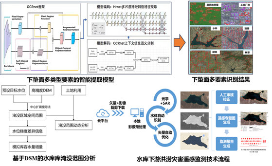
Remote Sensing Analysis Technology for Reservoir Inundation Areas
Applied Division of Hydrological Remote Sensing Technology
This division bridges technological research and operational needs, promoting the practical implementation of remote sensing technology in water conservancy applications. It serves water resource management, disaster prevention and mitigation, and ecological protection.
· Emergency Response for Flood Control and Drought Relief
· Remote Sensing Monitoring of Water Resources and Water Environment
· Remote Sensing Monitoring and Operational Support for Hydraulic Engineering
· Operational Application Systems for Hydrological Remote Sensing
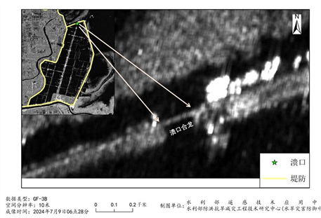
Remote Sensing Thematic Map of Breach Monitoring
Hydrological Remote Sensing Satellite Division
This division aims to enhance independent data acquisition capabilities, reduce reliance on foreign satellites, and support high-precision monitoring in water conservancy.
· Multi-Source Data Fusion Mechanism
· Thematic Satellite Data Products for Water Conservancy
· Hydrological Remote Sensing Satellite Platform
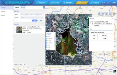
Spatial Data Support Platform for Flood Control Scheduling
Integrated Sky-Earth Division
This division integrates multi-dimensional data from satellite remote sensing, aerial drones, ground-based Internet of Things (IoT), and other sources to establish a comprehensive hydrological monitoring system.
· Sky-Earth Collaborative Observation Scheme
· Intelligent Sensing Devices
· BDS-based Water Conservancy Applications
· Digital Twin Watershed Development
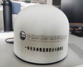
Integrated Multi-Parameter Monitoring BDS Receiver